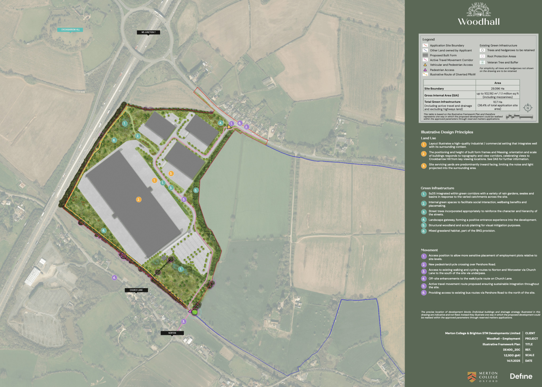
Define played a central role in shaping the planning and design strategy for the site, leading on the preparation of the Design & Access Statement and preparing a suite of other documents to support the application, including:
- Parameter plans: Development of landscape-led parameter plans to define building zones, heights, landscape buffers and green infrastructure corridors, ensuring development capacity was balanced with landscape sensitivity.
- Landscape and Visual Impact Assessment (LVIA): Comprehensive assessment of landscape and visual effects, informing design decisions and mitigation strategies throughout the scheme.
- Green infrastructure coordination: Integration of green infrastructure to optimise sustainable drainage, ecological connectivity and landscape structure, ensuring drainage and biodiversity objectives were embedded within the masterplanning framework.
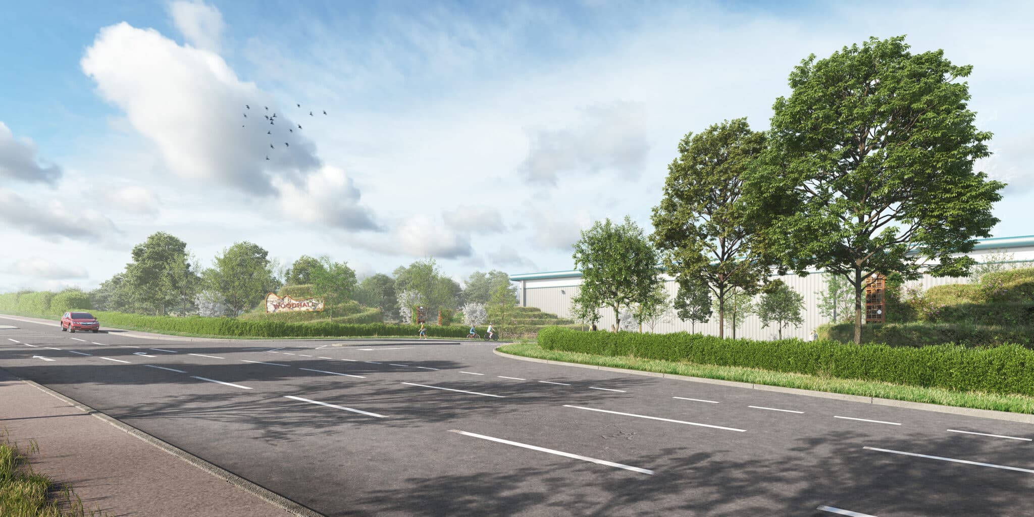
A key focus of Define’s work was the careful management of views towards Crookbarrow Hill, a distinctive and sensitive landmark within the local landscape and a scheduled monument. Using detailed visual analysis and semi-verified visualisation modelling, we tested building locations, heights and landform proposals to ensure the protection of important views from sensitive receptors and to demonstrate that development could be successfully accommodated within the wider landscape context.